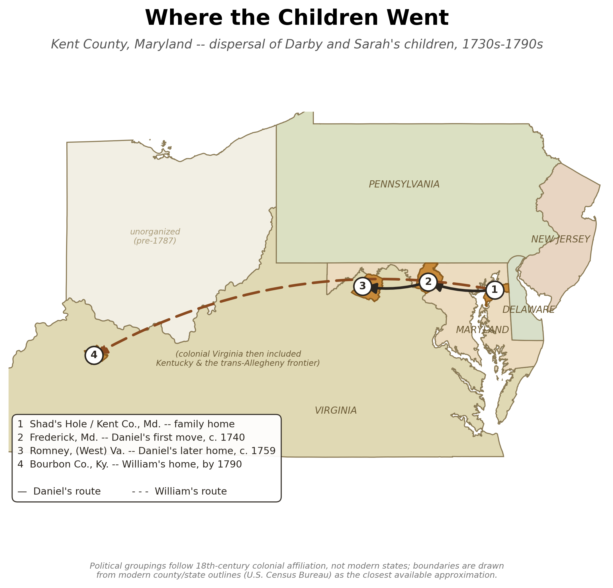
A regional dispersal map tracing two of Darby and Sarah's children away from the family's Kent County home: Daniel's move from Kent County to Frederick County, Maryland (c. 1740) and on to Hampshire County, Virginia/West Virginia, near Romney (c. 1759); and William's move to Bourbon County, Kentucky, where he was living by 1790.
How this map was made
Built from real U.S. Census Bureau county/state boundary data. Two deliberate simplifications, both noted on the map itself:
- Political groupings reflect 18th-century colonial affiliation, not modern states. Modern Virginia, West Virginia, and Kentucky are grouped and colored as a single "Virginia" for this era -- West Virginia did not become a separate state until 1863, and Kentucky remained part of Virginia until its own 1792 statehood. Ohio is shown as unorganized territory (no state government existed there before 1787). Maryland, Pennsylvania, New Jersey, and Delaware are shown individually, all four being established colonies for this whole period.
- The underlying shapes are still drawn from modern county/state outlines, as the closest practical stand-in for the actual (often vaguer, contested) 18th-century lines.
- Point locations for Frederick, Romney, and the representative Bourbon County location are approximate, placed from general geographic knowledge rather than surveyed coordinates.
- Frederick County, Maryland was not formally organized until 1748, a few years after Daniel's c. 1740 move into that area -- the map marks the general location, not a period-accurate county name at that exact date.